
Amerikaanse havens, Caribisch gebied – Covens & Mortier, c. 1740
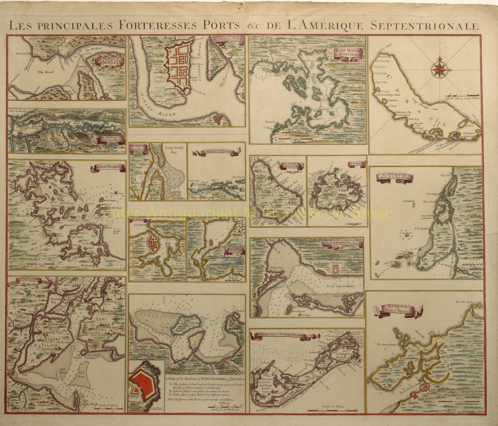
PORTS AND HARBORS OF NORTH AND SOUTH AMERICA AND THE WEST INDIES “Les Principales Forteresses Ports &c. De L’Amerique Septentrionale“.…
Lees verder€1.650
PORTS AND HARBORS OF NORTH AND SOUTH AMERICA AND THE WEST INDIES
“Les Principales Forteresses Ports &c. De L’Amerique Septentrionale“. Copper engraving published by Covens & Mortier c. 1740. Original hand colouring with later additions. Size: 48,8 x 61,5 cm.
This rare chart shows 18 separate maps of harbors and islands throughout North and South America. The sheet was created to accompany Covens & Mortier’s reduction of Henry Popple’s influential map of the British possessions in North America (1733). Popple’s chart was originally published in 20 sheets and the Amsterdam firm of Covens and Mortier reduced it to four, more manageable sheets. The maps included on this chart were derived from the insets on Popple’s map, and feature towns, forts, topography, soundings, shoals, and anchorages.
Included are the harbors of New York, Boston, Charleston, Providence (Rhode Island), St. Augustine (Florida), Anapolis Royal (Nova Scotia), Placentia (Newfoundland), Havana (Cuba), St. Iago (Santiago, Cuba), Kingston (Jamaica), Port Antonio (Jamaica), Fort Royal (Martinique), Cartagena (Colombia), and Portobelo (Panama), as well as the islands of Barbados, Antiqua, Bermuda, and Curaçao.
Price: Euro 1.650,-